
Mapa topográfico Schiedam
Mapa interactivo
Haga clic en el mapa para ver la altitud.
Acerca de este mapa
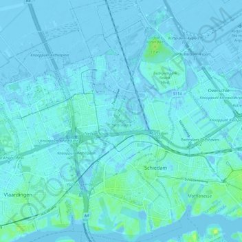
Nombre: Mapa topográfico Schiedam, altitud, relieve.
Lugar: Schiedam, Zuid-Holland, Nederland (51.89668 4.35067 51.96341 4.41771)
Altitud media: 1 m
Altitud mínima: -8 m
Altitud máxima: 14 m
Otros mapas topográficos
Haga clic en un mapa para ver su topografía, su altitud y su relieve.
Windas
Nederland > Zuid-Holland > Schiedam
Windas, Schiedam, Zuid-Holland, Nederland, 3121 KL, Nederland
Altitud media: 1 m