
Mapa topográfico Guéret
Mapa interactivo
Haga clic en el mapa para ver la altitud.
Guéret
Guéret has an oceanic climate (Köppen Cfb) influenced by its elevation and proximity to the Bay of Biscay's maritime inflow of Gulf Stream air. As a result, the climate is mild for its latitude, wet and also relatively gloomy.
Acerca de este mapa
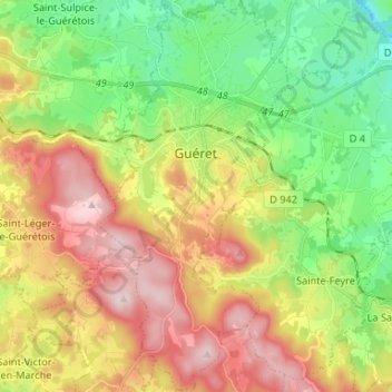
Nombre: Mapa topográfico Guéret, altitud, relieve.
Altitud media: 473 m
Altitud mínima: 308 m
Altitud máxima: 689 m
Otros mapas topográficos
Haga clic en un mapa para ver su topografía, su altitud y su relieve.
Lotissement les Peupliers
France > Nouvelle-Aquitaine > Creuse > La Souterraine > La Souterraine
Altitud media: 383 m