
Mapa topográfico Les Poulières
Mapa interactivo
Haga clic en el mapa para ver la altitud.
Les Poulières
The commune is positioned between Épinal to the west and Saint-Dié to the north-east, in the valley of the Neuné, a tributary of the Vologne River. Neighbouring communes are Biffontaine and La Chapelle-devant-Bruyères. Les Poulières is at the confluence of several roads, but roads here are small and twisting, thanks to the topography, on the western fringes of the Vosges Mountains.
Acerca de este mapa
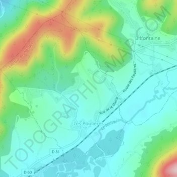
Nombre: Mapa topográfico Les Poulières, altitud, relieve.
Altitud media: 510 m
Altitud mínima: 438 m
Altitud máxima: 709 m