
Mapa topográfico Skyline
Mapa interactivo
Haga clic en el mapa para ver la altitud.
Acerca de este mapa
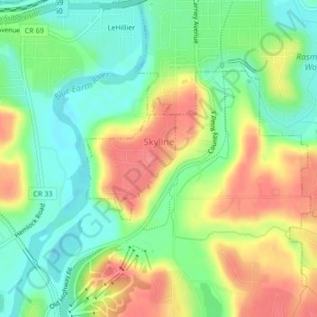
Nombre: Mapa topográfico Skyline, altitud, relieve.
Lugar: Skyline, Blue Earth County, Minnesota, United States (44.13553 -94.03959 44.14590 -94.02884)
Altitud media: 265 m
Altitud mínima: 230 m
Altitud máxima: 309 m
According to the U.S. Census Bureau, the city has a total area of 0.17 square miles (0.44 km2), all land. Its elevation is 980 feet (300 m) above sea-level.