
Mapa topográfico Little Current
Mapa interactivo
Haga clic en el mapa para ver la altitud.
Acerca de este mapa
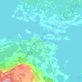
Nombre: Mapa topográfico Little Current, altitud, relieve.
Altitud media: 193 m
Altitud mínima: 172 m
Altitud máxima: 329 m
Otros mapas topográficos
Haga clic en un mapa para ver su topografía, su altitud y su relieve.
Rabbit Island
Canada > Ontario > Manitoulin District > Northeastern Manitoulin and the Islands
Rabbit Island, Northeastern Manitoulin and the Islands, Manitoulin District, Northeastern Ontario, Ontario, Canada
Altitud media: 187 m
McKenzie Island
Canada > Ontario > Manitoulin District > Northeastern Manitoulin and the Islands
McKenzie Island, Northeastern Manitoulin and the Islands, Manitoulin District, Northeastern Ontario, Ontario, Canada
Altitud media: 210 m