
Mapa topográfico Berkeley
Mapa interactivo
Haga clic en el mapa para ver la altitud.
Acerca de este mapa
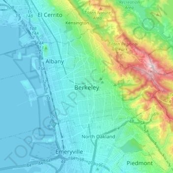
Nombre: Mapa topográfico Berkeley, altitud, relieve.
Lugar: Berkeley, Alameda County, California, United States (37.83573 -122.36868 37.90669 -122.23420)
Altitud media: 109 m
Altitud mínima: -5 m
Altitud máxima: 570 m
In 1866, Oakland's private College of California looked for a new site. It settled on a location north of Oakland along the foot of the Contra Costa Range (later called the Berkeley Hills) astride Strawberry Creek, at an elevation about 500 feet (150 m) above the bay, commanding a view of the Bay Area and the Pacific Ocean through the Golden Gate.