
Mapa topográfico Brückenfundamentloch Reichsautobahn Strecke 46, Fulda-Würzburg
Mapa interactivo
Haga clic en el mapa para ver la altitud.
Acerca de este mapa
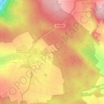
Nombre: Mapa topográfico Brückenfundamentloch Reichsautobahn Strecke 46, Fulda-Würzburg, altitud, relieve.
Altitud media: 307 m
Altitud mínima: 161 m
Altitud máxima: 379 m