
Mapa topográfico Tafresh
Mapa interactivo
Haga clic en el mapa para ver la altitud.
Acerca de este mapa
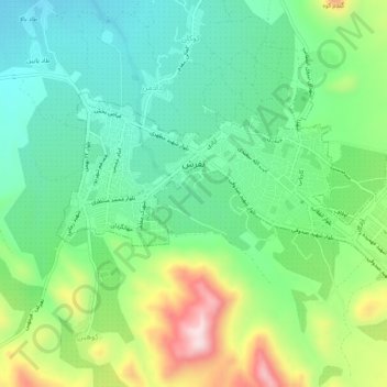
Nombre: Mapa topográfico Tafresh, altitud, relieve.
Altitud media: 1 956 m
Altitud mínima: 1 824 m
Altitud máxima: 2 233 m
The flight distance between Tehran and Tafresh is 170 km towards southwest. The average altitude of Tafresh is 1912 meters above sea level, with a continental and semi-arid climate with an annual rainfall of 270 mm.