
Gracias por apoyar a este sitio ❤️
Haz una donación
Haz una donación
Mapa topográfico West Jefferson
Haga clic en el mapa para ver la altitud.
Gracias por apoyar a este sitio ❤️
Haz una donación
Haz una donación
West Jefferson
West Jefferson is a popular destination among tourists and retirees from Florida, as well as those from the lower elevations of the Carolinas and Georgia.
Gracias por apoyar a este sitio ❤️
Haz una donación
Haz una donación
Acerca de este mapa
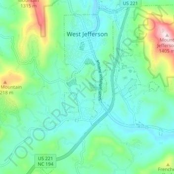
Nombre: Mapa topográfico West Jefferson, altitud, relieve.
Lugar: West Jefferson, Ashe County, North Carolina, United States (36.36200 -81.51109 36.41362 -81.46528)
Altitud media: 1 002 m
Altitud mínima: 884 m
Altitud máxima: 1 397 m
Gracias por apoyar a este sitio ❤️
Haz una donación
Haz una donación