
Mapa topográfico Abrantes
Mapa interactivo
Haga clic en el mapa para ver la altitud.
Acerca de este mapa
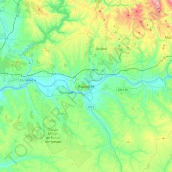
Nombre: Mapa topográfico Abrantes, altitud, relieve.
Altitud media: 162 m
Altitud mínima: 11 m
Altitud máxima: 612 m
An active republican center, Abrantes was the place of preparatory meetings for the 5 October 1910 Revolution, which may have contributed to the village's elevation to the status of city on 14 June 1916.