
Mapa topográfico Abadeh
Mapa interactivo
Haga clic en el mapa para ver la altitud.
Acerca de este mapa
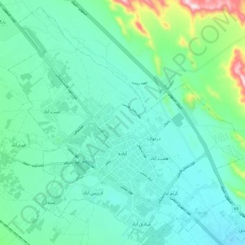
Nombre: Mapa topográfico Abadeh, altitud, relieve.
Altitud media: 2 043 m
Altitud mínima: 1 964 m
Altitud máxima: 2 374 m
Abadeh (Persian: آباده, also Romanized as Ābādeh) is a city and capital of Abadeh County, in Fars Province, Iran. Abadeh is situated at an elevation of 6,200 feet (1,890 m) in a fertile plain on the high road between Isfahan and Shiraz, 190 kilometres (120 mi) from the former and 270 kilometres (170 mi) from the latter. At the 2006 census, its population was 52,042, in 14,184 families. As of 2009, the population was estimated to be 59,042.