
Haz una donación
Mapa topográfico Al Hajar Mountains
Haga clic en el mapa para ver la altitud.
Haz una donación
Al Hajar Mountains
The high topography is around two major culminations: Jabal Akhdar and Saih Hatat, which are large scale anticlines. The Saih Hatat culmination contains eclogite in the northeast at As Sifah. These rocks were subducted to about 80 km (50 mi) depth into the mantle, and then exhumed back to the surface. This exhumation event created possibly the largest megasheath fold on Earth, the Wadi Mayh megasheath fold. The common view is that these eclogites were originally basic volcanic rocks within the leading edge of the continental crust of the Arabian Plate. This leading edge was then subducted by a NE-dipping subduction zone. However, some geologists have interpreted that these eclogites were subducted through a SW-dipping subduction zone.
Haz una donación
Acerca de este mapa
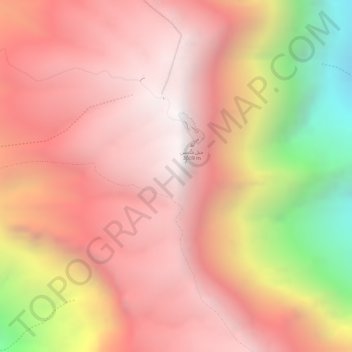
Nombre: Mapa topográfico Al Hajar Mountains, altitud, relieve.
Lugar: Al Hajar Mountains, Al Batinah South Governorate, Oman (23.23495 57.26245 23.23505 57.26255)
Altitud media: 2 502 m
Altitud mínima: 1 454 m
Altitud máxima: 2 985 m
Haz una donación
Otros mapas topográficos
Haga clic en un mapa para ver su topografía, su altitud y su relieve.