
Mapa topográfico East Champaran District
Mapa interactivo
Haga clic en el mapa para ver la altitud.
Acerca de este mapa
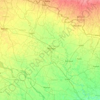
Nombre: Mapa topográfico East Champaran District, altitud, relieve.
Lugar: East Champaran District, Bihar, India (26.25457 84.48528 27.02168 85.29697)
Altitud media: 70 m
Altitud mínima: 50 m
Altitud máxima: 101 m
Raxaul is one of the most significant towns of the East Champaran district. By excellence of its topographical area, it is known as the Gateway to Nepal.
Otros mapas topográficos
Haga clic en un mapa para ver su topografía, su altitud y su relieve.
Sonbhadra
India > Bihar > Sonbhadra Banshi Suryapur
Sonbhadra, Sonbhadra Banshi Suryapur, Arwal District, Bihar, 824120, India
Altitud media: 74 m
Pashchim Champāran
Pashchim Champāran, Pashchim Champaran, Bihar, India
Altitud media: 207 m
Patna
India > Bihar > Patna Rural
Patna, Patna Rural, Patna District, Bihar, 800001, India
Altitud media: 51 m