
Mapa topográfico La Grange
Mapa interactivo
Haga clic en el mapa para ver la altitud.
La Grange
The center of La Grange has an elevation of 266 feet (81 m) above sea level.
Acerca de este mapa
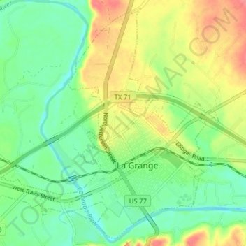
Nombre: Mapa topográfico La Grange, altitud, relieve.
Lugar: La Grange, Fayette County, Texas, United States (29.89160 -96.91546 29.94326 -96.85196)
Altitud media: 90 m
Altitud mínima: 64 m
Altitud máxima: 129 m