
Mapa topográfico Hilversumse Meent
Mapa interactivo
Haga clic en el mapa para ver la altitud.
Acerca de este mapa
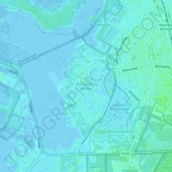
Nombre: Mapa topográfico Hilversumse Meent, altitud, relieve.
Lugar: Hilversumse Meent, Hilversum, Noord-Holland, Nederland (52.26420 5.13200 52.27650 5.14207)
Altitud media: 2 m
Altitud mínima: -4 m
Altitud máxima: 7 m
Otros mapas topográficos
Haga clic en un mapa para ver su topografía, su altitud y su relieve.
Einde Gooi
Nederland > Noord-Holland > Hilversum
Einde Gooi, N417, Hilversum, Noord-Holland, Nederland, 1213 TR, Nederland
Altitud media: 4 m
Spanderswoud
Nederland > Noord-Holland > Hilversum
Spanderswoud, Hilversum, Noord-Holland, Nederland
Altitud media: 5 m
Zanderij Crailoo
Nederland > Noord-Holland > Hilversum
Zanderij Crailoo, Hilversum, Noord-Holland, Nederland, 1217 DZ, Nederland
Altitud media: 7 m