
Mapa topográfico Maasveld II
Mapa interactivo
Haga clic en el mapa para ver la altitud.
Acerca de este mapa
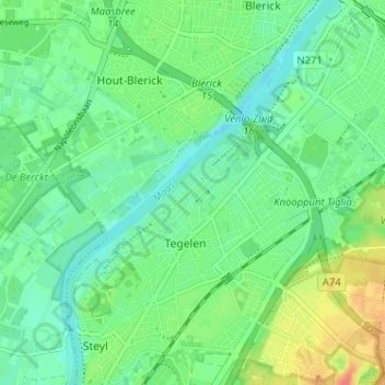
Nombre: Mapa topográfico Maasveld II, altitud, relieve.
Altitud media: 24 m
Altitud mínima: 9 m
Altitud máxima: 52 m
Otros mapas topográficos
Haga clic en un mapa para ver su topografía, su altitud y su relieve.
Maasveld I
Nederland > Limburg > Tegelen > Maasveld I
Maasveld I, Tegelen, Venlo, Limburg, Nederland, 5931SG, Nederland
Altitud media: 23 m