
Mapa topográfico Sugar Hill
Mapa interactivo
Haga clic en el mapa para ver la altitud.
Acerca de este mapa
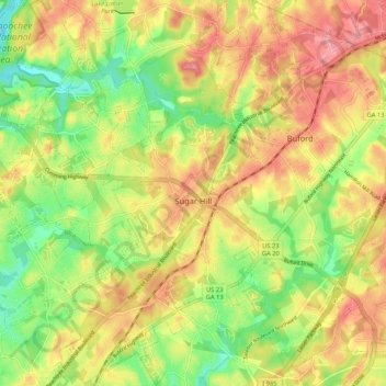
Nombre: Mapa topográfico Sugar Hill, altitud, relieve.
Lugar: Sugar Hill, Gwinnett County, Georgia, United States (34.06466 -84.10169 34.15187 -84.01418)
Altitud media: 332 m
Altitud mínima: 277 m
Altitud máxima: 383 m
According to the United States Census Bureau, as of 2010 the city of Sugar Hill had a total land area of 10.6 square miles (27.5 km2), of which 0.04 square miles (0.1 km2), or 0.33%, was water. The U.S. Geological Survey lists the city's elevation as 1,149 feet (350 m).