
Mapa topográfico Toulouse
Mapa interactivo
Haga clic en el mapa para ver la altitud.
Acerca de este mapa
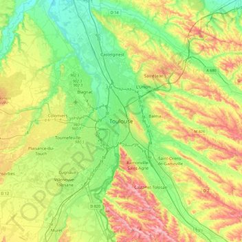
Nombre: Mapa topográfico Toulouse, altitud, relieve.
Altitud media: 173 m
Altitud mínima: 104 m
Altitud máxima: 288 m
The first half of the 14th century was a prosperous period, despite the dismemberment in 1317 of the very large bishopric of Toulouse (which lost two thirds of its area and a large part of its income, a loss only partially compensated by its elevation to the rank of archbishopric), and the episode of the Shepherds' Crusade which brought a pogrom against Toulouse's Jewish population in 1320.