
Mapa topográfico Pine Mountain Club
Mapa interactivo
Haga clic en el mapa para ver la altitud.
Pine Mountain Club
Pine Mountain Club has an area of 16.7 square miles (43.25 km2). It ranges from 4,901 to 6,400 feet (1,494 to 1,951 m) in elevation. The community sits in a deep valley of the San Emigdio Mountains, on the San Andreas fault. It is surrounded by Los Padres National Forest. The settlement lies between Apache Saddle and Pinon Pines Estates along Mil Potrero Highway. It is west of Frazier Park, Lebec, and Interstate 5.
Acerca de este mapa
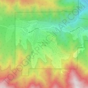
Nombre: Mapa topográfico Pine Mountain Club, altitud, relieve.
Altitud media: 1 867 m
Altitud mínima: 1 328 m
Altitud máxima: 2 548 m