
Mapa topográfico Hawarden
Mapa interactivo
Haga clic en el mapa para ver la altitud.
Acerca de este mapa
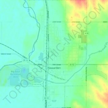
Nombre: Mapa topográfico Hawarden, altitud, relieve.
Lugar: Hawarden, Sioux County, Iowa, United States (42.98198 -96.50035 43.01867 -96.46095)
Altitud media: 365 m
Altitud mínima: 348 m
Altitud máxima: 406 m
Otros mapas topográficos
Haga clic en un mapa para ver su topografía, su altitud y su relieve.
Sioux County
United States > Iowa > Sioux County
Sioux County, Iowa, United States
Altitud media: 418 m
Chatsworth
United States > Iowa > Sioux County > Chatsworth > Chatsworth
Chatsworth, Sioux County, Iowa, 51011, United States
Altitud media: 359 m
Chatsworth
United States > Iowa > Sioux County
Chatsworth, Sioux County, Iowa, 51011, United States
Altitud media: 357 m