
Mapa topográfico Kerman
Mapa interactivo
Haga clic en el mapa para ver la altitud.
Kerman
Kerman is located on a high margin of Kavir-e Lut (Lut Desert) in the south-central part of Iran. The city is surrounded by mountains. Kerman is also located along the Saheb Al Zman mountain. The city is 1,755 m (5,758 ft) above sea level, making it third in elevation among provincial capitals in Iran. Winter brings very cold nights to Kerman. Mountains in the south and southeast Jftan Joopar and Plvar and Kerman have snow all year round. Kerman is located at latitude 30.29 and longitude 57.06.
Acerca de este mapa
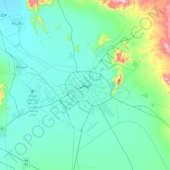
Nombre: Mapa topográfico Kerman, altitud, relieve.
Altitud media: 1 821 m
Altitud mínima: 1 723 m
Altitud máxima: 2 403 m