
Mapa topográfico Table Mountain
Mapa interactivo
Haga clic en el mapa para ver la altitud.
Acerca de este mapa
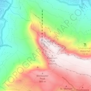
Nombre: Mapa topográfico Table Mountain, altitud, relieve.
Altitud media: 583 m
Altitud mínima: 130 m
Altitud máxima: 1 078 m
Table Mountain is at the northern end of a sandstone mountain range that forms the spine of the Cape Peninsula that terminates approximately 50 kilometres (30 mi) to the south at the Cape of Good Hope and Cape Point. Immediately to the south of Table Mountain is a rugged "plateau" at a somewhat lower elevation than the Table Mountain Plateau (at about 1,000 m or 3,300 ft), called the "Back Table". The "Back Table" extends southwards for approximately 6 km to the Constantia Nek-Hout Bay valley. The Atlantic side of the Back Table is known as the Twelve Apostles, which extends from Kloof Nek (the saddle between Table Mountain and Lion's Head) to Hout Bay. The eastern side of this portion of the Peninsula's mountain chain, extending from Devil's Peak, the eastern side of Table Mountain (Erica and Fernwood Buttresses), and the Back Table to Constantia Nek, does not have a single name, as on the western side. It is better known by the names of the conservation areas on its lower slopes: Groote Schuur Estate, Newlands Forest, Kirstenbosch Botanical Gardens, Cecilia Park, and Constantia Nek.
Otros mapas topográficos
Haga clic en un mapa para ver su topografía, su altitud y su relieve.
Llandudno Beach
South Africa > Western Cape > City of Cape Town > Cape Town > Llandudno
Llandudno Beach, Llandudno, Cape Town Ward 74, Cape Town, City of Cape Town, Western Cape, South Africa
Altitud media: 108 m
Trafalgar Park
South Africa > Western Cape > City of Cape Town > Cape Town
Trafalgar Park, Cape Town Ward 115, Cape Town, City of Cape Town, Western Cape, 7925, South Africa
Altitud media: 50 m
Green Point Park
South Africa > Western Cape > City of Cape Town > Cape Town
Green Point Park, Green Point, Cape Town, City of Cape Town, Western Cape, 8005, South Africa
Altitud media: 30 m
Table Mountain (Maclear's beacon)
South Africa > Western Cape > City of Cape Town > Cape Town
Table Mountain (Maclear's beacon), Cape Town, City of Cape Town, Western Cape, 7735, South Africa
Altitud media: 675 m
Nantes
South Africa > Western Cape > City of Cape Town > Cape Town
Nantes, Silvertown, Cape Town, City of Cape Town, Western Cape, South Africa
Altitud media: 14 m
Silvermist Estate
South Africa > Western Cape > City of Cape Town > Cape Town
Silvermist Estate, Cape Town Ward 74, Cape Town, City of Cape Town, Western Cape, 7848, South Africa
Altitud media: 272 m
Blinkwater
South Africa > Western Cape > City of Cape Town > Cape Town
Blinkwater, Bakoven, Cape Town Ward 54, Cape Town, City of Cape Town, Western Cape, 8005, South Africa
Altitud media: 293 m
Elsieskraal River
South Africa > Western Cape > City of Cape Town > Cape Town
Elsieskraal River, Pinelands, Cape Town Ward 53, Cape Town, City of Cape Town, Western Cape, 7450, South Africa
Altitud media: 11 m
Newlands Forest
South Africa > Western Cape > City of Cape Town > Cape Town
Newlands Forest, Cape Town, City of Cape Town, Western Cape, South Africa
Altitud media: 331 m
Rietvlei Wetland Reserve
South Africa > Western Cape > City of Cape Town > Cape Town
Rietvlei Wetland Reserve, Otto Du Plessis Drive, Sunset Beach, Cape Town Ward 113, Cape Town, City of Cape Town, Western Cape, 2251, South Africa
Altitud media: 5 m
Castle of Good Hope
South Africa > Western Cape > City of Cape Town > Cape Town
Castle of Good Hope, Oranje Bastion, Foreshore, Cape Town Ward 115, Cape Town, City of Cape Town, Western Cape, 8001, South Africa
Altitud media: 38 m