
Mapa topográfico Britton Hill
Mapa interactivo
Haga clic en el mapa para ver la altitud.
Britton Hill
Britton Hill is the highest natural point in the state of Florida, United States, with a summit elevation of 345 feet (105 meters) above mean sea level. Britton Hill is the lowest state highpoint in the United States, 103 feet (31 m) lower than the next lowest highpoint, Ebright Azimuth in Delaware, and far lower than many skyscrapers in Miami and other urban areas of Florida.
Acerca de este mapa
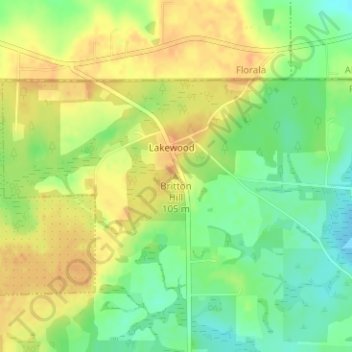
Nombre: Mapa topográfico Britton Hill, altitud, relieve.
Lugar: Britton Hill, Walton County, Florida, 32538, United States (30.98636 -86.28157 30.98646 -86.28147)
Altitud media: 93 m
Altitud mínima: 73 m
Altitud máxima: 109 m
Otros mapas topográficos
Haga clic en un mapa para ver su topografía, su altitud y su relieve.