
Mapa topográfico Chas
Mapa interactivo
Haga clic en el mapa para ver la altitud.
Acerca de este mapa
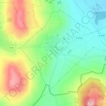
Nombre: Mapa topográfico Chas, altitud, relieve.
Altitud media: 413 m
Altitud mínima: 323 m
Altitud máxima: 551 m
Chas is located at 23°38′N 86°10′E / 23.63°N 86.17°E / 23.63; 86.17. It has an average elevation of 210 metres (688 feet). The municipality is situated on the banks of Garga river. Chas is located at the junction of National Highway 23 and National Highway 32. The Dhanbad-Bokaro-Ranchi Expressway also passes through it.