
Mapa topográfico Nieuwolda
Mapa interactivo
Haga clic en el mapa para ver la altitud.
Acerca de este mapa
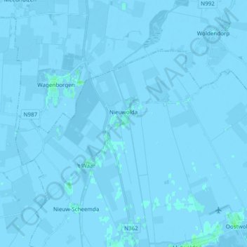
Nombre: Mapa topográfico Nieuwolda, altitud, relieve.
Lugar: Nieuwolda, Oldambt, Groningen, Nederland (53.21394 6.92864 53.26714 7.07974)
Altitud media: -1 m
Altitud mínima: -7 m
Altitud máxima: 4 m
In Nieuwolda bevindt zich het museumgemaal De Hoogte dat door een historische Bronsmotor wordt aangedreven. Het kinderwagenmuseum is gevestigd in een monumentale boerderij uit ± 1750 (schuur) resp. 1905 (voorhuis). Ten noordwesten van Nieuwolda ligt sinds 1980 het Hondshalstermeer. Door het dorp loopt de Internationale Dollardroute voor fietsers. Langs Nieuwolda loopt de N362.
Otros mapas topográficos
Haga clic en un mapa para ver su topografía, su altitud y su relieve.
Nieuw Beerta
Nederland > Groningen > Oldambt
Nieuw Beerta, Oldambt, Groningen, Nederland
Altitud media: -2 m
Nieuw Scheemda
Nederland > Groningen > Oldambt
Nieuw Scheemda, Oldambt, Groningen, Nederland
Altitud media: -1 m
Winschoterdiep
Nederland > Groningen > Oldambt
Winschoterdiep, Oldambt, Groningen, Nederland, 9636AL, Nederland
Altitud media: 0 m